Author: Elizabeth Budd
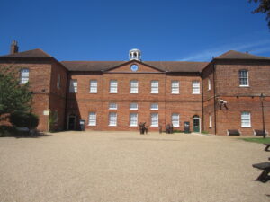
Most my work this term has been part of Team Workhouse, which is a research project that aims to create a digital reconstruction of the Gressenhall Workhouse in Norfolk, England during the 18th century in order to better understand the lived experience of workhouse inmates (my research this summer and presentation at the Midwest Conference on British Studies is also part of the Team Workhouse). This term, I’ve been working mainly on locating British parishes in the early 19th century. Our goal is to create maps and explore spatial relations of workhouses in England, based on an 1803 Parliamentary report. Professor Susannah Ottaway ’89 and others have already done significant work on finding the locations of the parishes and other places mentioned in the report. There are still many that don’t have locations, however, and that is what I’ve been working on. Although we ultimately want to know where the workhouses were, that information is not accessible to us at this time. We can find the location the churches, and often workhouses were very close to churches. In addition, the maps will be show larger areas, so individual parishes will be relatively small. As such, we have decided to use church buildings as approximations for the parishes and their poor relief.
My typical process looks like this: I would have a parish name (for example, Dowley, Magna, Wellington Division, Bradford Hundred in Shropshire), and would begin on a genealogy website to find out some preliminary information about the parish. I can typically get a church name (for example, Holy Trinity), and I then look to the Historic England pages for more information on the church building. This is the Historic England page for Holy Trinity, Great Dowley, from which I know that the current building is from 1845, although the site is older. I find the church on Google Maps (with the map on Historic England to help me), and use the coordinates for the parish.

Some places pose more challenges and require more investigation. In London, many of the parish churches of parishes listed in the 1803 report were destroyed in the Great Fire of London in 1666 and never rebuilt. For those parishes, I used this map, which shows London before the Fire. Even so, the streets have changed since then, so I had to estimate where the churches would have been. Another very common issue I have run into is name changes. “Warnslow” becomes “Warslow,” “Laytham” becomes “Layham,” and “Monythustoine” becomes “Mynyddyslwyn” (or “Mynyddislwyn” or “Mynydd Islwyn”). Some name changes are close enough that I am confident they are the same place, especially given the extra information, such as church name or county. Others, I find sources about the different names (especially that last one) to confirm that they are indeed the same place. For the most difficult parishes, I often had to resort to Google searches, old maps (there are many here!), and any other resources I could find on small parishes. I increasingly appreciate parish websites that have histories of their own parishes, which have been very valuable to me during this processes. It has taken many hours, but I have almost finished finding the unknown parishes, so before long we can move on to mapping the parishes and exploring the spatial patterns of 18th century poor relief.


